Handheld GPS Survey Equipment, High-Precision Rugged Land
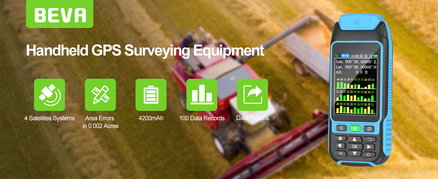
Handheld GPS Survey Equipment, High-Precision Rugged Land Surveying Equipment for Mountainous Terrain, Farmland, Forest, Ranch, Mining Lake
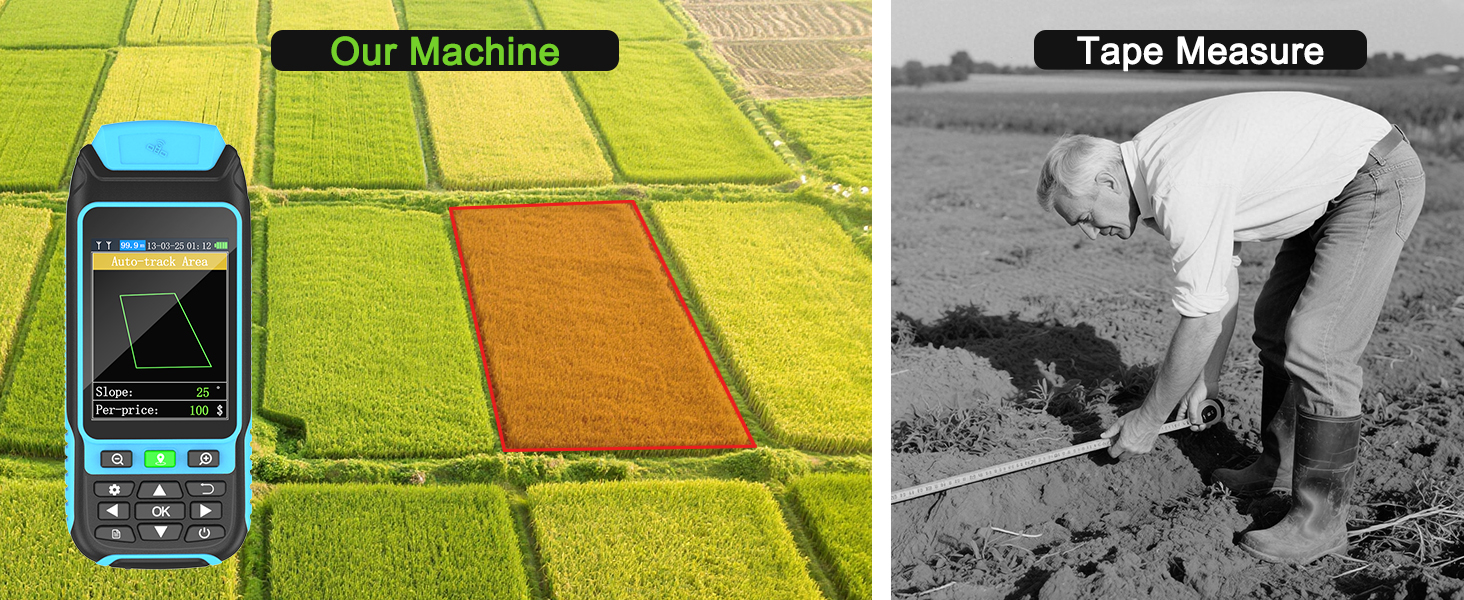
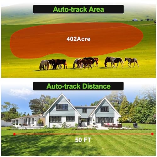
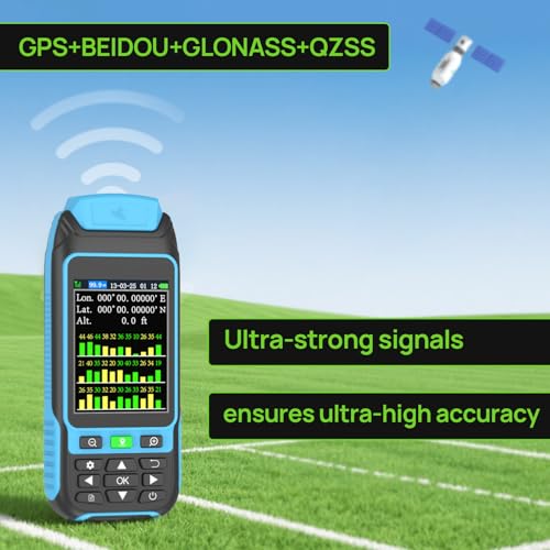
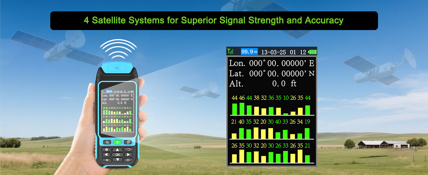
- High Precison Accuracy: This handheld survey device is powered by 4 satellite positioning systems, GPS+BEIDOU+GLONASS+QZSS, which provide ultra-accurate signals that can be controlled to within ±0.002 acres.
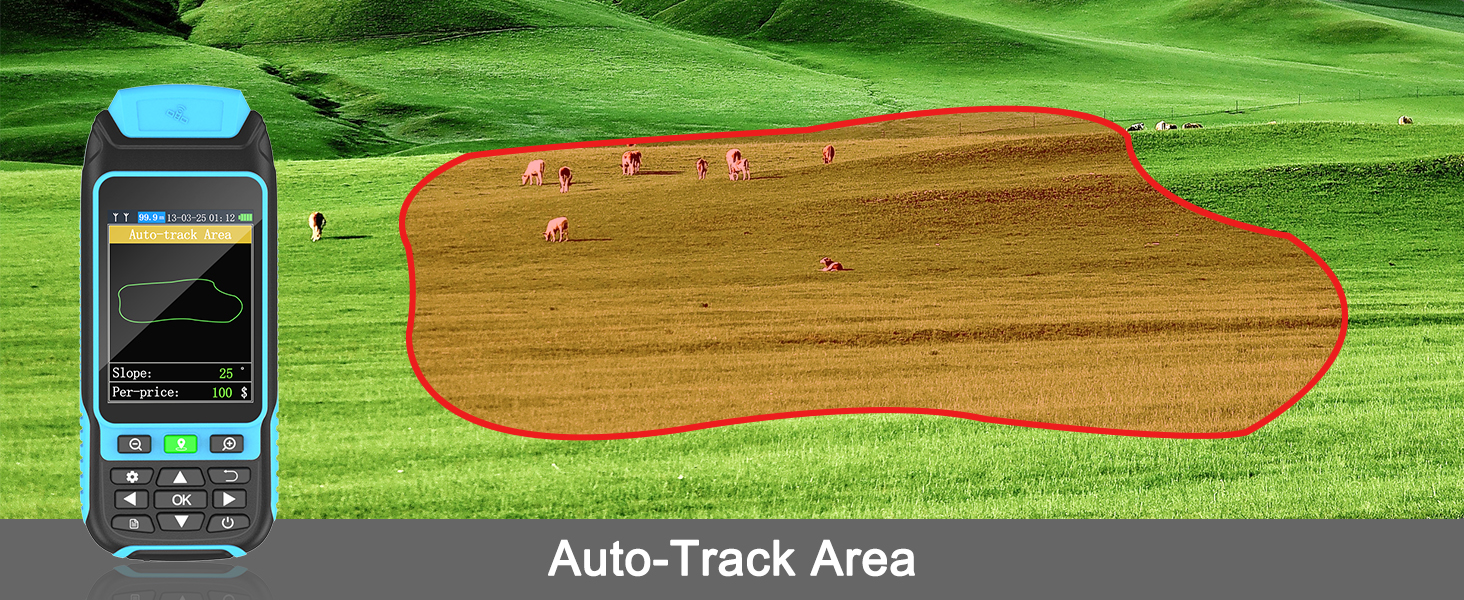
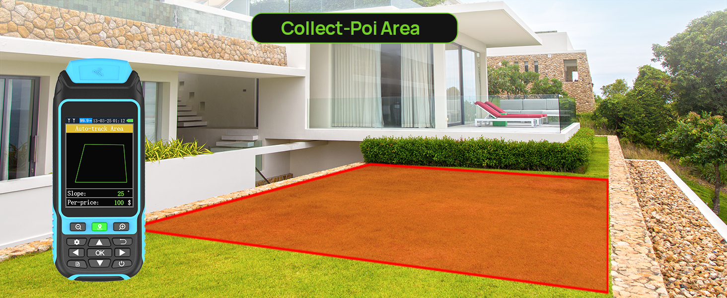
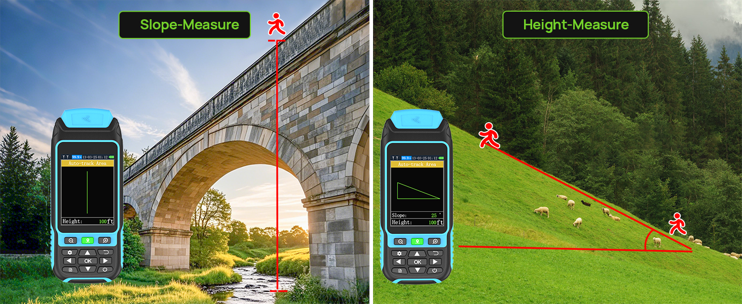
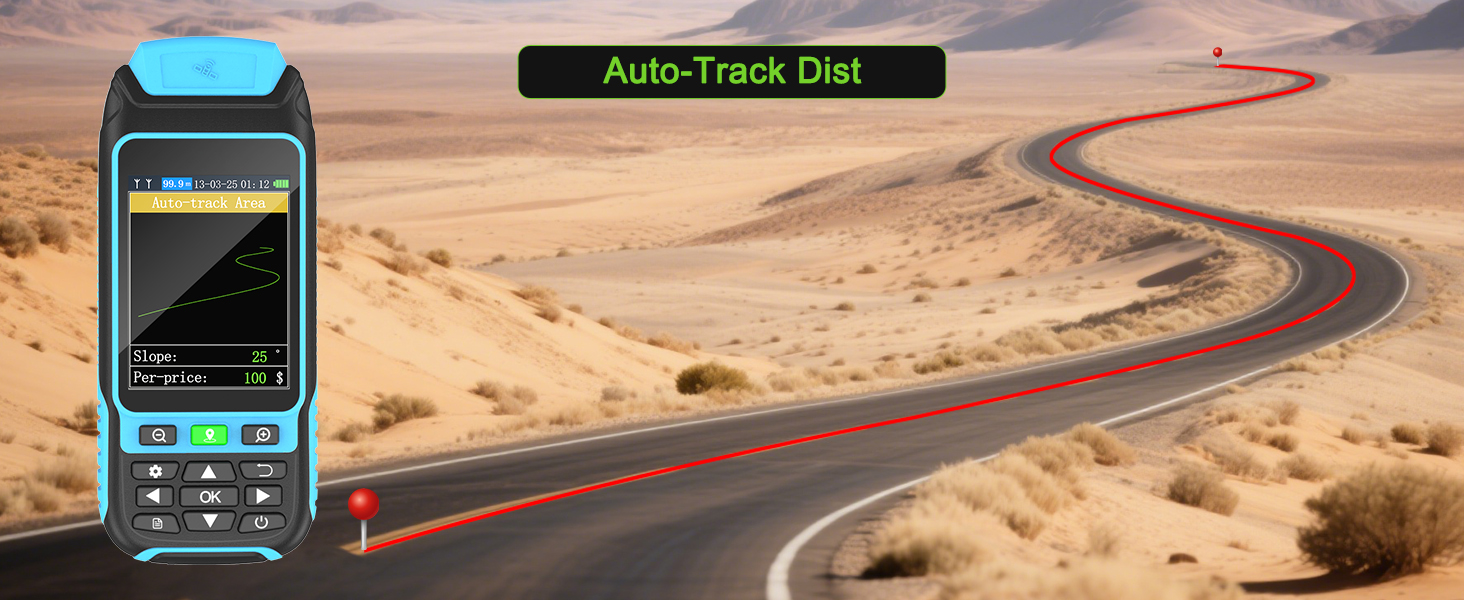
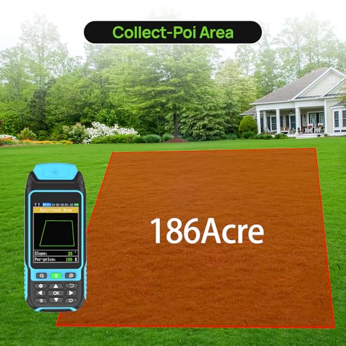
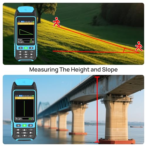
- Multiple Measurement Modes: Three measurement modes are supported to measure the area of any terrain such as farmland, garden, parking lot and pasture, and different measurement modes can be set according to different terrains, which is more convenient and efficient. It also supports distance and slope measurement.
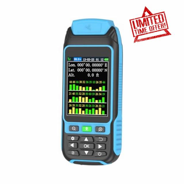
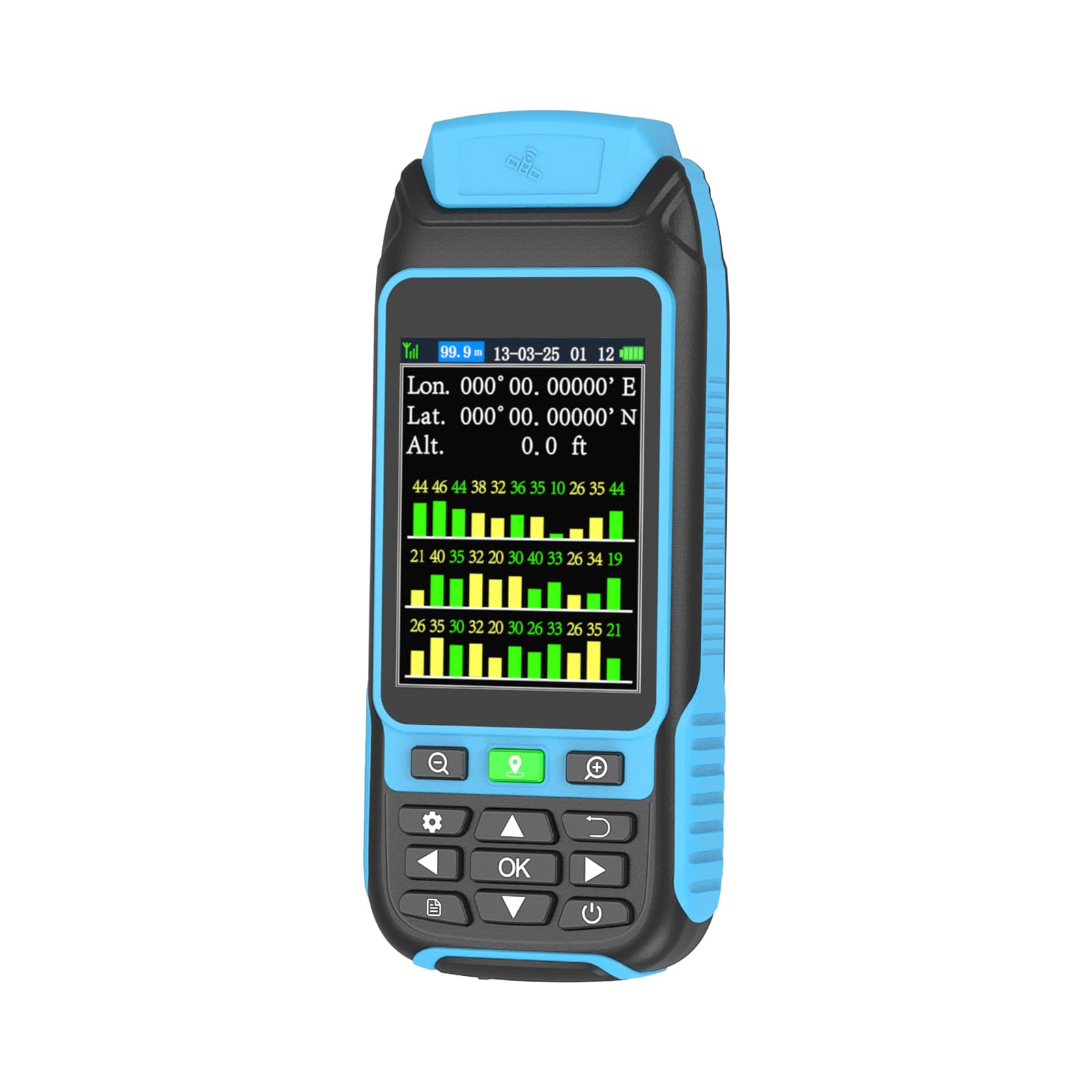
- 3.2 Inch HD Display: Featuring an anti-glare TFT screen with a backlight mode, data can be read clearly in dark environments or under bright midday light.
- Durable and Resonable Design: With strong waterproof and dust-proof function, Survives sudden storms & muddy job sites; With portable design, fits in your hand or pockets perfectly; Rubberized case offers a comfortable feeling of grip.
- Note: Please search for satellite signals in an open area outdoors and start measuring after the data stops fluctuating. Regular charging can better maintain the life cycle of the device.
Five Different Measurement Modes to Quickly Measure a Wide Range of Terrain!
Choose Different Units of Measurement According to Your Usage Habits
| SKU: | B0F2MJC5CH |
| Brand: | BEVA |
| Pack Quantity: | 1 |
| Manufacture: | BEVA |
| Quantity: | 1 |
Product Description
Five Different Measurement Modes to Quickly Measure a Wide Range of Terrain!
Previous page