Huairdum Marine GPS navigator, 5 inch IP65
Huairdum Marine GPS navigator, 5 inch IP65 waterproof GPS navigator for boats
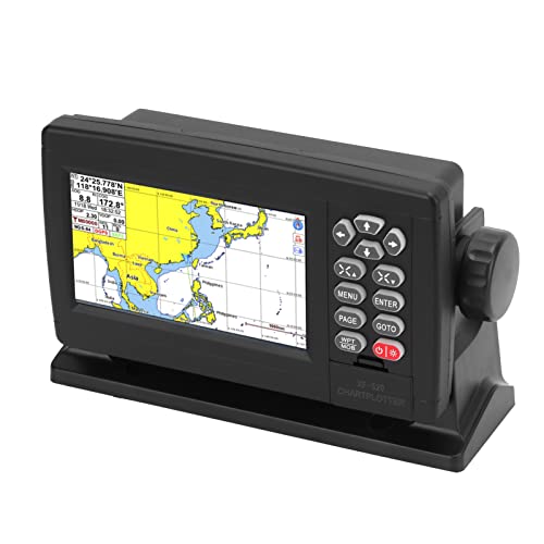
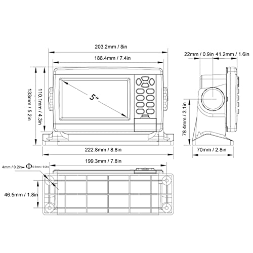
- Basic Parameter: Marine GPS navigation uses 5in color TFT LCD screen, with 480 x 272 (WVGA) resolution, LED backlight, wide viewing angle color screen, wide voltage design, DC12‑36V, in line with many standards, reliable in use.
- Well Designed: GPS navigator has IP65 waterproof level, stepless backlight setting, multiple setting methods, comfortable night use mode, real time voice broadcast of navigation, humanized voice prompts and alarms. With positive and negative anti reverse
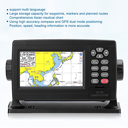
- Accurate Positioning: Marine GPS navigator adopts high accuracy compass and GPS dual mode positioning, and the position, speed and heading information are more accurate. Support multiple languages, six screen mode, users can switch freely.
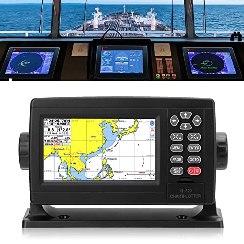
- Detailed Chart Information: GPS Navigator has large memory, large storage capacity for waypoints, markers and planned routes, with comprehensive Asian charts, detailed large scale charts and more efficient chart . Dynamic real time plotting of all
- Double Chart System: Built in C MAP MAP and XINUO MAP dual chart system, users can switch independently, we provide regularly updated network charts, the low power high performance core processor, dedicated graphics processor to draw charts, quickly displ
Feature:
1. Basic Parameter: Marine GPS navigation uses 5in color TFT LCD screen, with 480 x 272 (WVGA) resolution, LED backlight, wide viewing angle color screen, wide voltage design, DC12‑36V, in line with many standards, reliable in use.
2. Accurate Positioning: Marine GPS navigator adopts high accuracy compass and GPS dual mode positioning, and the position, speed and heading information are more accurate. Support multiple languages, six screen mode, users can switch freely.
3. Double Chart System: Built in C MAP MAP and XINUO MAP dual chart system, users can switch independently, we provide regularly updated network charts, the low power high performance core processor, dedicated graphics processor to draw charts, quickly display marine charts.
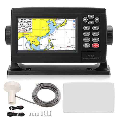
4. Support Storage Card: GPS Navigator can be easily upgraded from our website via a USB flash drive (not included), the front USB flash drive is used to upgrade charts and software, it can also backup and copy user data, and can install storage card and SIM card devices (not included).
5. Detailed Chart Information: GPS Navigator has large memory, large storage capacity for waypoints, markers and planned routes, with comprehensive Asian charts, detailed large scale charts and more efficient chart . Dynamic real time plotting of all AIS targets and motion vectors.
6. Well Designed: GPS navigator has IP65 waterproof level, stepless backlight setting, multiple setting methods, comfortable night use mode, real time voice broadcast of navigation, humanized voice prompts and alarms. With positive and negative anti reverse polarity protection.
7. Characteristic: Marine GPS navigation supports for AIS data, GPS data, 3D navigation, compass, has 10,000 waypoints, 200 routes (100 points each), 10,000 2 marker points, 200 boundary lines (40 points each), 1.5 million track points.
8. Various Installation Method: GPS navigator supports embedded installation or multi angle adjustment installation, and

| SKU: | B0BDXMLH28 |
| Dimensions: | 31 x 26 x 13 cm |
| Brand: | Huairdum |
| Model: | EntatialHQ7lqmu |
| Manufacture: | Huairdum |